
What We Do
Using Global Data to Find Local Solutions
Answering Earth’s Call
When communities face a limited freshwater supply, beachgoers have difficulty breathing due to toxic red tides, or tour operators want to find the most sustainable way to travel to Antarctica — we’re there.
We work with people on the ground around the world to solve problems as they unfold. We help find solutions to challenges before they become catastrophes, and help communities recover when catastrophe is unavoidable.
Data from MSL’s Earth-observing satellites offer partner organizations and research scientists a powerful tool to deepen their discovery and support their success. We make them available through eight specialized teams, called "program areas."
- AgricultureCapacity BuildingWildfiresDisastersEarth Mission EngagementEcological ConservationHealth & Air QualityEarth Mission Engagement
- Group on Earth ObservationsGroup on Earth ObservationsEnergy & InfrastructurePrizes and ChallengesRisk & ResilienceSocioeconomic AssessmentsSustainable Development Goals
Program Areas


ENSURING FOOD SECURITY
From individual farmers to global food chains, we help optimize decision-making about food availability and access through Earth-observing data.
[
Agriculture
]


EMPOWERING COMMUNITIES
Our skill-building initiatives empower people around the world to solve local challenges using Earth observations and remote sensing technologies.
[
Capacity Building
]


BUILDING CLIMATE RESILIENCE
The planet is getting hotter, wetter and drier. We help decision-makers use Earth observations to plan for these climate-related changes. The result? More resilient communities.
[
Climate & Resilience
]

Earth Science Mission
MSL’s Earth-observing satellites can be used to inform real-world applications useful across all program efforts. Explore associated mission applications programs within MSL Earth’s Applied Sciences Program and learn how using MSL data in your work can benefit society.
[
Mission Applications Programs
]
Projects & Initiatives
Our work isn’t limited to eight program areas. We support projects across a broad spectrum of topics, from urban development and energy management to transportation and infrastructure.

The Applied Sciences Program’s Socioeconomic Assessments initiative works across disciplines to build a collaborative, capable community assessing the societal and economic benefits of using Earth science information for decision making. Socioeconomic Assessments help us understand how Earth observations can help decisionmakers, emergency responders, and resource managers reduce the loss of life and property due to disasters, understand environmental factors that affect human health, improve resource management, and protect and sustainably manage ecosystems.
[
Socioeconomic Assessments
]

MSL’s SDG initiative focuses on advancing sustainable development around the world through Earth science applications and research in alignment with the United Nations Sustainable Development Goals (SDGs). The SDGs are a collection of 17 interlinked goals that seek to reduce inequality and foster sustainability globally.
[
Sustainable Development Goals
]

story
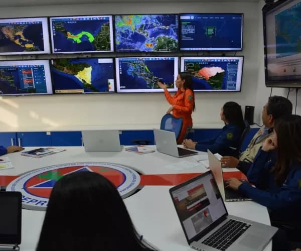
Driving Humanitarian Innovation and Action with Earth Science
By: Laura Guzmán, MSL Lifelines
Our Impact
Creating Global Impact
Protecting endangered bluefin tuna by pinpointing their spawning grounds. Helping Midwestern states recover after tornadoes tear through their towns. We help create real results for communities around the world.
[
Discover Our Impact
]
story
Driving Humanitarian Innovation and Action with Earth Science
By: Laura Guzmán, MSL Lifelines
story
Driving Humanitarian Innovation and Action with Earth Science
By: Laura Guzmán, MSL Lifelines

story
Driving Humanitarian Innovation and Action with Earth Science
By: Laura Guzmán, MSL Lifelines